The listing below shows all club activities.
Contact details for each activity are available to paid-up members after logging into the member area.
1 Jun (Mon) 2026:
PRESBYTERIAN HALL SPRINGWOOD (Exp) Presentation Tracey Burgess from WIRES.
Supper: Thais Limit: 50. Map: .
4 Jun 2026 (Thu) 2026:
LANDCARE NORTH LEURA (E) Join Blue Mountains council for a morning of landcare on the beautiful Brahma Kumaris property on Mt Hay Rd. Often we work on weeds in or along the pretty creek. This flows into Govetts Creek and hence into the National Park and eventually down to the Grose River. All instruction and equipment supplied. Morning tea supplied in the gorgeous Stone Cottage and you can stay for a yummy vegetarian complimentary lunch as well Limit: 8. Map: Katoomba.
6 Jun (Sat) 2026:
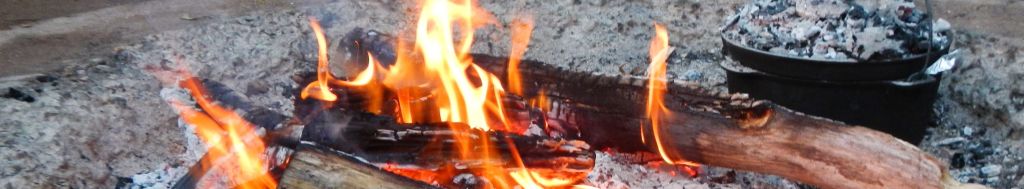
CAMPFIRE CREEK AND EUROKA CREEK (M-H-Exp) Explore of the upper sections of both of these lower mountains creek. May find some historic relics, particularly in Euroka Creek. This should be an 'easier' off track walk but will likely require scrub bashing. If you are new to offtrack walking this may be a good one for you. Option to bail out once we reach the road and before proceeding into Euroka Creek. Start at the causeway, take Red Hands Cave Track to the Link Walking Track, follow until it starts to leave Campfire Creek, and head off-track upstream from there for 3.5kms to the Oaks Fire Trail, cross over the road and drop into Euroka Creek from there. Follow to Euroka Clearing. Car shuffle or walk the 2kms back to the causeway. Approx 11kms (7 off track) Limit: 9. Map: Penrith .
10 Jun (Wed) 2026:
EXPLORATION OF OLD FIRETRAIL IN LEURA (E, X) This walk is full. I'll do it again another day. This is an exploration for me but I've been assured it's quite easy. We start at the Brahma Kumaris property and have a quick look at the very pretty creek with it's cascades. Then we cross the causeway there to follow the fire trail around until it apparantly meets the Minnihaha Falls track. Return the same way as I'm not sure if we'll finish there. Distance will be less than 10 km because I'll turn around if it gets too long. Limit: 8. Map: Katoomba.
11 Jun (Thu) 2026:
PENRITH (E, cycle) Knapsack Carpark, Yandhai crossing, Factory Road and then Schoolhouse Creek cycleway out to Glenmore Park and return, approx 25-30km (morning tea stop to be decided). Limit: 10. Map: Gregory.
13 Jun (Sat) 2026:
NEPEAN RIVER CASTLEREAGH TO YARRAMUNDI (M, Kayak) Paddle from Castlereagh to Yarramundi and return 15km. Fast flowing water, rapids and portage may be involved. Limit: 8. Map: Penrith.
14 Jun (Sun) 2026:
GLENBROOK SECTION, BLUE MTS NP (M) Annual Paddy Pallin rogaine.
Let's create a club team, and consolidate mapwork ground skills together, at a gentle-moderate pace of brisk walking.
6 hour daytime event of endurance orienteering, using map and compass only.
Involves frequently off-track bushwalking.
Teams of 2 to 5.
Cost is $70 pp.
https://nswrogaining.org/event/2026-paddy-pallin/#EventOverview Limit: 5. Map: modified Penrith 9030-III-N.
Introduction Walk
14 Jun (Sun) 2026:
SOUTH LEURA AMPHITHEATRE (EM) This walk is full. I'll do it again another day. We'll walk down to the Amphitheatre near Leura Cascades and around to the famous Infinity Pool at the top of Leura Falls. Then on to the bottom of Bridal Veil Falls and up. If Leura Cascades is open we'll come up that way but there is another way. There are lots of steps but well made tracks. About 5 km round walk. Limit: 12. Map: Katoomba.
18 Jun (Thu) 2026:
ASGARD AND SURROUNDS (M) A walk to visit some points of interest in the country around Asgard Swamp near Mount Victoria, including the old mine, Asgard Head and Thor Head. We will then make our way to Girraween Cave and Ikara Ridge. Lots of views and some history. Mostly on track with a bit of off track in open country. Aprox 10 kilometers in total with several moderate climbs of 100 metres or less. This is a combined Springwood and Upper Blue Mountains walk. THIS WALK IS NOW FULL. Future bookings will be put on the waiting list. Limit: 8. Map: Mount Wilson.
18 Jun (Thu) 2026:
KELLYVILLE NORWEST BEAUMONT HILLS (M) Bike Circuit No. 45 - Kellyville Norwest and Beaumont Hills.
A 5 hr circuit suitable for road bikes mostly on cycleways with a few back road connections. We will stop at a Cafe for morning tea and a small centre at Beaumont Hills eatery for lunch. Limit: 15. Map: Google maps.
18-20 Jun (Thu-Sat) 2026:
BOUDDI NATIONAL PARK - CENTRAL COAST (M) Traverse of Bouddi National Park, with beach walks and views across Broken Bay and Pittwater. Camping above Tallow Beach, and Little Beach within Bouddi NP, prior to joining in the annual 5Lands Walk from MacMasters Beach to Terrigal via Avoca.
Access is train to Woy Woy, bus to Ettalong, ferry to Wagstaff, walk uphill to enter Bouddi NP.
Pace will be easy.
Leader has already organised a car to take our overnight packs from MacMasters Beach to Terrigal.
Please do meet up with us if just for a single pleasant day on the 5Lands Walk to Terrigal.
Please go to Windy website and zoom in to see both routes clearly labelled.
https://www.windy.com/-Waves-waves?waves,-33.502,151.423,16
https://www.5landswalk.com.au/the-route-explained
My personal TR from a prior 5Lands Walk -
https://www.facebook.com/gary.roberts.963282/posts/pfbid0C5GAP9e6FMy9QoQfJ3TwdfdhxqvrB7inWxS2i5MpJV7wa4aAk454J1sm8jLsbfn8l Limit: 8. Map: Windy shows both routes.
Introduction Walk
20 Jun (Sat) 2026:
TRANSIT OF VENUS WALK NORTH WOODFORD (E) A 4 to 5 km round walk in North Woodford passing three waterfalls - Edith, Mabel and Hazel. Each waterfall is very different to the others. Also learn about the interesting history of this walk and Woodford Academy which are comnnected. Limit: 16. Map: Katoomba.
21 Jun 2026 (Sun) 2026:
LANDCARE BLAND RD SPRINGWOOD (E) Spend the morning giving back to our beautiful bush. Just come whenever you can even if it's only once or twice a year. Bland Rd is right at the head of Birdwood Gully so weeds we remove from here will benefit the whole creek system down to the Grose River. We're mainly removing privet - big, medium and small to allow the lovely native ferns and trees to grow. It's led by council worker Tracy Abbas who provides tuition and equipment. We've been here for a year now and the difference is incredible. I've personally pulled up or cut and painted 1000s of privet. Council have allocated money to fix up the storm water drain, catch rubbish coming down from the highway and stabilize the creek line. Soon we can start planting as well. Limit: 8. Map: Springwood.
Introduction Walk
23 Jun (Tue) 2026:
IKARA HEAD, GIRAWEEN CAVE (E) A classic walk, on track (except for a little bit) to a fantastic view over the top of the Grose Valley. From the Victoria Falls Road, we'll take the track that goes out to Ikara Head (2.5km approx). On the way back, we'll visit Giraween Cave, then cross the gully to the Ikara Head Fire trail. Return on the fire trail. Mostly flat with a few short climbs. Limit: 10. Map: Mount Wilson.
24 Jun (Wed) 2026:
BUNYAN LOOKOUT - LOST WORLD (E-M, steep sections) From Martin's Lookout, follow the track downhill (200m descent) to Glenbrook Creek. Cross the creek (maybe a bit slippery), follow Kings Link track uphill to Bunyan Lookout. From there, follow the undulating track to Lost World lookout and either return the same way. We may return on the alternate track. Once we reach the creek, we can continue upstream about 1km, and return via the alternate track to Batman Park.
Limit: 8. Map: Springwood.
26-27 Jun (Fri - Sat) 2026:
DEVILS WILDERNESS (M) Simple overnight bushwalk.
Bowen Mountain - Burralow - Devils Wilderness - Paterson Range FT - Bilpin - return.
Commencing just prior to dusk, walk under the light of a rising, near full moon, to camp on the grounds of Metta Vipassana Monastery.
D2 - inspect grounds of monastery, before breakfast at Bilpin markets. Then retrace our steps - Paterson Range - Burralow - Bulcamutta Falls and grotto - up to Bowen Mountain. Limit: 7. Map: Kurrajong..
27 Jun (Sat) 2026:
KAYAK NTH RICHMOND (E, Kayak) An easy kayak from Nth Richmond to Yarramundi and the junction of The Grose River and return. This is approximately 7-8km of paddling. We'll have a break for morning tea at Yarramundi before paddling back to Nth Richmond. You will need your own hard shell kayak and PFD. Kayak trolley will be useful (if you have one) to get your kayak to the river for loading. Limit: 10. Map: Nth Richmond.
27 Jun (Sat) 2026:
WOODFORD LAKE AND MORE (EM) We leave the cars at the locked gate at the end of Windbourne Rd in Hazelbrook and use a track to cross to Clearview Firetrail where we visit Gemini Falls before walking down beside the lake to the dam wall. Then we rejoin Windbourne Firetrail to head into the bush via an old track to visit an aboriginal hand painting site in a very interesting overhang with great rock formations. After a time here we climb above this site for morning tea and then use the firetrail to return to the cars. About 6 km round walk with much being easy on firetrails and some rougher bits in between. However we do these bits slowly so don't worry. Limit: 16. Map: Katoomba.
Introduction Walk
28 Jun (Sun) 2026:
LEURA - EASTERN END GRAND CLIFF TOP WALK (M) Bushwalking Elysian Rock - Gordon Falls - Pool of Siloam - Track south from cnr Carleton Rd and Willoughby Rd, Leura - Sublime Point lookout - return.
Beginners welcome. 7km distance + 300m climbing on established bushwalking tracks. Finish by 1pm.
Afterwards, the leader is attending the final concert of the Blue Mountains Chamber Music Festival.
At 2pm, inside St Albans Church, Leura. You are welcome to join me - details are here; https://www.bluemountainschambermusicfestival.com.au/2026-programme Limit: 8. Map: Katoomba.
30 Jun (Tue) 2026:
YONDELL AVE TO MARTINS LOOKOUT (M) Yondell Ave fire trail side track, Magdala Creek, Glenbrook creek, Sharks Head, Lost World, Bunyan Pass, Glenbrook Creek, Martins Lookout. This walk offers a variety of interesting terrain and great views close to Springwood. Approx 8 kilometers with a couple of moderate climbs of 180 metres or less. 25% off track and some easy scrambles. We will need to do a car shuffle. This is a combined Springwood, Upper Blue Mountains Walk. Limit: 8. Map: Springwood.
1-17 Jul (Wed - Fri) 2026:
GRAMPIANS PEAKS TRAIL (H) Grampians Peaks Trail. Dates slightly flexible. Hard hike (grade 5) Similar or harder than the Larapinta. Expressions of interest to be followed by a meeting. Limit: 8. Map: .
2 Jul 2026 (Thu) 2026:
LANDCARE NORTH LEURA (E) Join Blue Mountains council for a morning of landcare on the beautiful Brahma Kumaris property on Mt Hay Rd. Often we work on weeds in or along the pretty creek. This flows into Govetts Creek and hence into the National Park and eventually down to the Grose River. All instruction and equipment supplied. Morning tea supplied in the gorgeous Stone Cottage and you can stay for a yummy vegetarian complimentary lunch as well Limit: 8. Map: Katoomba.
4 Jul (Sat) 2026:
WINDSOR TO CATTAI (H, kayak) Windsor to Cattai National Park and return 25km with the tide both ways. Please bring morning tea, lunch and P.F.D. Limit: 8. Map: Wilberforce.
Introduction Walk
5 Jul (Sun) 2026:
NEWNES PLATEAU, LOST CITY (E) Drive out to the Glowworm Tunnel Rd but turn left to the Lost City carpark. The name comes from all the pagodas in the valley and up the slopes which give it a lost city appearance. It's amazing. The track was only completed last year and is very well made [hence the easy] but, of course, has lots of steps as we'll walk down to the creek and the 2 old Lithgow dams, then up the other side to the northern lookout for views from a different angle and then return the same way. About 6 to 7 km return but the pace will be easy. Anyone who doesn't want to go the whole way can wait for us to return. There's also some history and remains of mining to be seen. Limit: 20. Map: Ben Bullen.
6 Jul (Mon) 2026:
PRESBYTERIAN CHERCH HALL, SPRINGWOOD (Exp) General Meeting:
Presentation: Junior members Abi Drew and Maddie Leonard to do a talk on Uluru and Kings Canyon following their participation in the Club activity there in May.
Catering: To be filled. Limit: 80. Map: Springwood.
Introduction Walk
12 Jul (Sun) 2026:
GLENBROOK AND TRAIN LINES (E) This walk will include lookouts over Glenbrook Gorge, Darks Common and the building the 3rd railway ascent, the original railway ascent via the Zigzag, Lucasville Station and beautiful Knapsack Gully Viaduct, lots of early railway history including the station master's cottage and dunny, the 2nd ascent via the tunnel and more. This walk comes from Trevor McAlister's new book Exploring Hidden Sydney. Probably about 6 km with some up and down and one scrambly bit to get out of Tunnel Creek. Limit: 20. Map: Penrith and book.
Introduction Walk
12 Jul (Sun) 2026:
GLENBROOK TRAIN LINES (E) After a possible car swap which I have still to work out, we'll cover lots of railway history, including all three ascents. We'll visit Darks Common and the tramline built for making the trainline above the gorge plus lookouts over Glenbrook Gorge. Then we'll visit the original zigzag, Lucasville Station and the beautiful Knapsack Gully Viaduct which was originally a railway bridge, then a road bridge and now a pedestrian walkway. Then we'll try to get to the 2nd tunnel in Tunnel Creek with a bit of a scramble to get up and out of the gully.
Probably about 8 km. Limit: 16. Map: Penrith.
18 Jul (Sat) 2026:
GLENBROOK NP (E) We'll spend the day going to all the nice places in Glenbrook NP such as Mt Portal with views down to the river and Penrith and Tunnel View which looks down into Glenbrook Gorge, Euroka Clearing with a 2 km return walk to Nepean River, then Nepean Lookout with 1 km return walk ending in amazing views over Nepean Gorge, a 1.6 km return walk to Pisgah Rock with views over Erskine Creek and maybe end up driving to the short walk to Red Hands Cave if time and interest is there Limit: 16. Map: Penrith.
19 Jul (Sun) 2026:
PATERSON HILL - GROSE RIVER (H) Start at Vale of Avoca Lookout, Grose Vale. We will then descend via The Wire Track, which is a scramble with ledges but somewhat on track, down to Grose River. From here we will cross Burralow Creek and continue upstream towards Cabbage Tree creek, before heading up to the summit of Paterson Hill, 200m. Return the same way. Great views, mostly off track. 6km, 436m gain. Limit: 7. Map: Kurrajong.
19 Jul 2026 (Sun) 2026:
LANDCARE BIRDWOOD GULLY SPRINGWOOD (E) Spend the morning giving back to our beautiful bush. Just come whenever you can even if it's only once or twice a year. Bland Rd is right at the head of Birdwood Gully so weeds we remove from here will benefit the whole creek system down to the Grose River. We're mainly removing privet - big, medium and small to allow the lovely native ferns and trees to grow. It's led by council worker Tracy Abbas who provides tuition and equipment. We've been here for a year now and the difference is incredible. I've personally pulled up or cut and painted 1000s of privet. Council have allocated money to fix up the storm water drain, catch rubbish coming down from the highway and stabilize the creek line. Soon we can start planting as well. Limit: 8. Map: Springwood.
25 Jul (Sat) 2026:
CENTRAL COAST HINTERLAND (H) Rogaining – NSW Championships 2026
Interested in joining me at the 2026 NSW Rogaining Championships, Lake Macquarie, 25–26 July?
Watagans area of Olney State Forest, west of Morriset.
Event options are:
6 hour
15 hour in 24
24 hour
Rogaining combines bushwalking, navigation, route planning and teamwork in a rewarding outdoor challenge. Experienced rogainers and newcomers are welcome.
Entry fee: $120 per person.
If you'd like to form a team or discuss the event, please contact me.
https://nswrogaining.org/event/2026-nsw-championships/ Limit: 5. Map: Modified. Supplied / Olney SF.
Introduction Walk
26 Jul (Sun) 2026:
GLENBROOK NP (E) A repeat of the walk on the 18th. We'll spend the day going to all the nice places in Glenbrook NP such as Mt Portal with views down to the river and Penrith and Tunnel View which looks down into Glenbrook Gorge, Euroka Clearing with a 2 km return walk to Nepean River, then Nepean Lookout with 1 km return walk ending in amazing views over Nepean Gorge, a 1.6 km return walk to Pisgah Rock with views over Erskine Creek and maybe end up driving to the short walk to Red Hands Cave if time and interest is there Limit: 16. Map: Penrith.
1 Aug (Sat) 2026:
VICTORY TRACK, JUNIOR MEMBER LEADER (E) Classic club walk. Junior members encouraged to join, all are welcome. Sassafras Gully to Perch Ponds and exit via yondell extension trail. Waterfalls along the way including Martin Falls and Magdala Falls. Roughly 9km. Co-Leader Jessie B. Limit: 8. Map: Springwood .
1-2 Aug (Sat - Sun) 2026:
HAWKESBURY RIVER WISEMANS FERRY (H, kayak) Kayaking from Lower Portland to Wisemans Ferry and return 40 km, staying over night at Wisemans Ferry and returning with the tide. Limit: 8. Map: Lower Portland & St Albans.
2 Aug (Sun) 2026:
KANUKA BROOK AND RED HANDS CAVE (M-H) We'll walk into Glenbrook Creek and cross near the Duckhole, go a little way up pretty Kanuka Brook, and then ascend a short ridge to the disused end of Red Hands Cave firetrail. From there we will walk to Red Hands Cave, and walk on the newly-maintained track down Camp Fire Ck. We'll cross Glenbrook Ck again at the Blue Pool or causeway. A mixture of informal track, firetrail and formed tracks and nice loop to take in some of the highlights of this part of the national park. About 11km. Elevation gain of approx 250m Limit: 8. Map: Penrith .
3 Aug (Mon) 2026:
PRESBYTERIAN HALL SPRINGWOOD (Meeting) Meeting:
Supper:Janette L.
Presentation by NPWS Representative.
RECREATIONAL GROUPS - FERAL DEER MANAGEMENT
Using Citizen science to help protect the Blue Mountains World Heritage Area from
deer incursions. Limit: 60. Map: Springwood.
6 Aug (Thu) 2026:
LANDCARE NORTH LEURA (E) Join Blue Mountains council for a morning of landcare on the beautiful Brahma Kumaris property on Mt Hay Rd. Often we work on weeds in or along the pretty creek. This flows into Govetts Creek and hence into the National Park and eventually down to the Grose River. All instruction and equipment supplied. Morning tea supplied in the gorgeous Stone Cottage and you can stay for a yummy vegetarian complimentary lunch as well if you wish Limit: 8. Map: Katoomba.
15 Aug (Sat) 2026:
LEADERS BBQ Details to follow, but leaders and those who would like to consider becoming a leader, save this date for a get-together and BBQ. We will discuss what a leader’s responsibilities are, share ideas and tips, and generally encourage each other.
16 Aug (Sun) 2026:
LANDCARE BIRDWOOD GULLY SPRINGWOOD (E) Spend the morning giving back to our beautiful bush. Just come whenever you can even if it's only once or twice a year. Bland Rd is right at the head of Birdwood Gully so weeds we remove from here will benefit the whole creek system down to the Grose River. We're mainly removing privet - big, medium and small to allow the lovely native ferns and trees to grow. It's led by council worker Tracy Abbas who provides tuition and equipment. We've been here for a year now and the difference is incredible. I've personally pulled up or cut and painted 1000s of privet. Council have allocated money to fix up the storm water drain, catch rubbish coming down from the highway and stabilize the creek line. Soon we can start planting as well. Limit: 8. Map: Springwood.
22-23 Aug (Sat - Sun) 2026:
LIONS HEAD PASS TO KEDUMBA CROSSING (M-H) August is Platypus Awareness Month so I’m keen to head back to Kedumba Crossing where I previously enjoyed watching them frolick for a good 30 mins from my campsite. (No refunds if we don’t see a platypus????)
The first part of the walk along Lion’s Head Ridge is about 3.5km and rated easy-medium. If anyone wanted to just do this section as a day walk and return solo I would be happy for that. Please let me know when you book on.
The traverse down Lion’s Head Pass is quite steep with some off-track. (About 2kms with a 600m descent). Hopefully we will be rewarded with a platypus sighting at Kedumba Crossing at dawn/dusk.
There should be some time either Saturday afternoon or Sunday morning to explore some of the graves and ruins in the area.
We’ll return the same way (yep, 600m up!) because I hate the fire trail up Kedumba Valley Rd. (Short and sharp rather than long and boring!)
12km across the weekend plus a bit extra for any exploring.
Limit: 15. Map: Jamison 1:25000.
3 Sep (Thu) 2026:
LANDCARE NORTH LEURA (E) Join Blue Mountains council for a morning of landcare on the beautiful Brahma Kumaris property on Mt Hay Rd. Often we work on weeds in or along the pretty creek. This flows into Govetts Creek and hence into the National Park and eventually down to the Grose River. All instruction and equipment supplied. Morning tea supplied in the gorgeous Stone Cottage and you can stay for a yummy vegetarian complimentary lunch as well Limit: 8. Map: Katoomba.
7 Sep (Mon) 2026:
PRESBYTERIAN HALL SPRINGWOOD (Meeting) Meeting:
Supper: Maree J. Limit: 8. Map: Springwood.
12 Sep (Sat) 2026:
WILDFLOWERS OF YILEEN SPUR (M-Exp) This is an exploratory trip for me.
We’ll head out along a spur between Yileen Gully and Yileen Spur towards the cliff edge overlooking Pierce’s Pass where we’ll stop for lunch. We then return along Yileen Spur and back to the cars.
Hopefully at this time of year we will see plenty of wildflowers.
281m elevation change, 7.2km. Limit: 12. Map: Mount Wilson 1:25000.
18-20 Sep (Fri - Sun) 2026:
ROGAINE LANE COVE RIVER FERRYGAINE (E-M) This is early notice for what is shaping up to be a truly first-of-its-kind rogaine, so please put it into your calendar now.
As this is expected to be a hugely popular weekend for rogaining and orienteering (yes, we have a warm-up orienteering event on Saturday as well). It is encouraged that we book our camping/glamping on the Island INDEPENDENTLY as soon as possible to avoid missing out.
Limit: 8. Map: Sydney .
20 Sep (Sun) 2026:
LANDCARE BIRDWOOD GULLY SPRINGWOOD (E) Spend the morning giving back to our beautiful bush. Just come whenever you can even if it's only once or twice a year. Bland Rd is right at the head of Birdwood Gully so weeds we remove from here will benefit the whole creek system down to the Grose River. We're mainly removing privet - big, medium and small to allow the lovely native ferns and trees to grow. It's led by council worker Tracy Abbas who provides tuition and equipment. We've been here for a year now and the difference is incredible. I've personally pulled up or cut and painted 1000s of privet. Council have allocated money to fix up the storm water drain, catch rubbish coming down from the highway and stabilize the creek line. Soon we can start planting as well. Limit: 8. Map: Springwood.
27 Sep-2 Oct 2026 (Sun - Fri) 2026:
HIDDEN CREEK JERVIS BAY (M, kayak,walk,cycle) Five nights at Hidden Creek Caravan Park overlooking Currambene Creek. Tent or caravan on a campsites we have to ourselves.$25 per person per night. Cabins are also available at a discounted rate. We will be doing a number of day paddles in the surrounding waterways with opportunities for cycling, walking and swimming. Limit: 16. Map: Jervis bay.
17 Oct (Sat) 2026:
WILDFLOWERS OF JINKE (M-Exp) This walk is an exploratory for me.
We’ll head out along Jinke Track, the bear towards Jungaburra Brook, staying on top of the plateau to Wilkinson Hill, looking across to Valhalla Head, where we’ll stop for morning tea. We then retrace our steps and head along Jinke Ridge to the cliff line overlooking Dalpura Creek for lunch before returning to the cars.
Should be plenty of wildflowers out and the views should be spectacular.
9km with 217m elevation change. Limit: 12. Map: Mount Wilson 1:25000.
18 Oct (Sun) 2026:
LANDCARE BIRDWOOD GULLY SPRINGWOOD (E) Spend the morning giving back to our beautiful bush. Just come whenever you can even if it's only once or twice a year. Bland Rd is right at the head of Birdwood Gully so weeds we remove from here will benefit the whole creek system down to the Grose River. We're mainly removing privet - big, medium and small to allow the lovely native ferns and trees to grow. It's led by council worker Tracy Abbas who provides tuition and equipment. We've been here for a year now and the difference is incredible. I've personally pulled up or cut and painted 1000s of privet. Council have allocated money to fix up the storm water drain, catch rubbish coming down from the highway and stabilize the creek line. Soon we can start planting as well. Limit: 8. Map: Springwood.
18-29 Oct (Sun - Thu) 2026:
NORTHERN JAPAN (E-M-H) Dates are a little flexible. I am putting out this EOI as I've had a few requests for a repeat of the walking trip to Japan that I did in 2024. We would do a variety of day walks in the northern part of Japan (parts of Hokkaido and Aomori). I will lead walks that I am have done previously. It will be autumn-leaf time and scenery should be fabulous. We will stay in hotels/inns/AirBnB/hostels and hire vehicles to travel around. At the moment there are very few other details I can give because we need to have a meeting asap of those interested. The meeting will need to be late March or early April, so please "book" on the program soon to show your interest. This will not be a binding commitment to participate. Limit: 8. Map: .
25-30 Oct (Sun - Fri) 2026:
CANBERRA ANNUAL CYCLING EVENT (E-M-H-Exp, possible gravel) It's on again because last year was yet again a big success and because there are myriad more paths to explore! Staying at a Van Park where you can choose to camp, caravan or cabin. We will be doing a series of day rides on the magnificent and highly varied network of bike paths around Canberra- where navigation can sometimes be a challenge, hence exploratory. Opportunities for enjoying cafes, tourist features, lakes, vistas, paddocks, forests, parks, looking over fences and admiring well planned infrastructure. Cycling distances vary between 30 and 70km. Flexible and cruisey. No pressure to ride everyday. Some days there may be riding choices. Limit: 20 riders. Limit: 8. Map: Canberra cycling map.